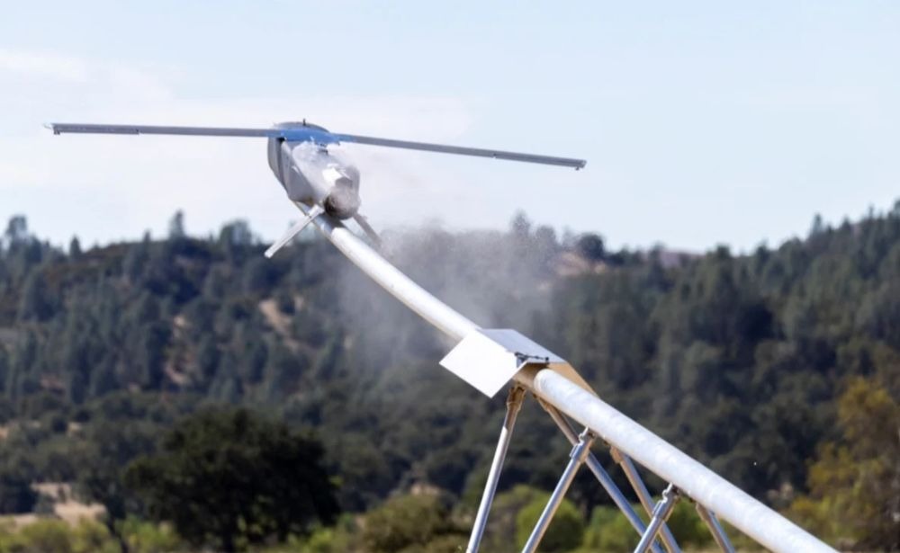
The test of the Lumberjack strike drone at the Fort Hunter Liggett training center in California went off without surprises: the vehicle took off several times, flew its route, and landed. Nothing special.
In reality, the flight demonstrated the next stage of navigation technology: the expendable strike drone never once turned to GPS for help, navigating by the planet’s magnetic field instead. Notably, Ukrainian developers have been solving the same problem in combat conditions for two years now.
How It Works: The ‘Magnetic Fingerprint’ Principle
Earth’s magnetic field is a field with local distortions. Different rock formations in the Earth’s crust are magnetized differently, so each area of terrain has its own unique ‘magnetic relief,’ similar to a fingerprint.
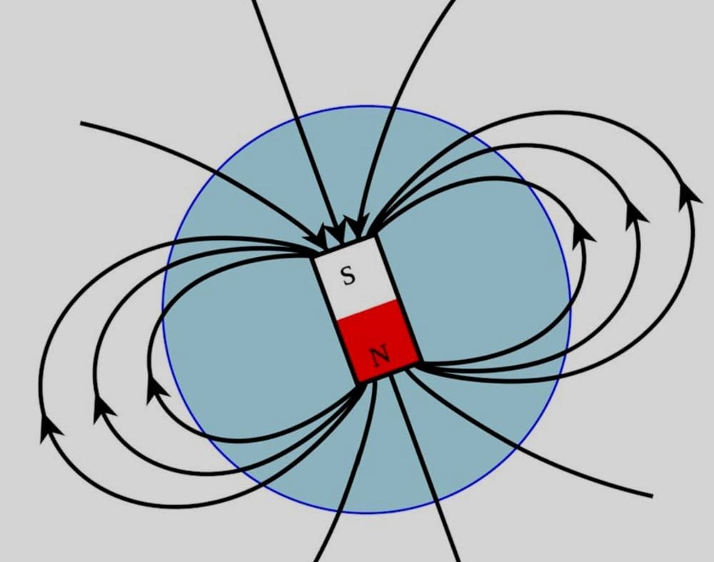
If this relief is measured in advance and mapped, it is then sufficient to compare the drone’s current readings against this map — and the vehicle ‘knows’ where it is without any external signal.
The system’s operating cycle looks like this:
- An ultra-sensitive magnetometer on board continuously measures the magnetic field strength beneath the vehicle.
- Filtering algorithms subtract excess ‘noise’ in real time.
- The cleaned data is compared against a pre-loaded digital map of magnetic anomalies for the given area.
- The onboard computer finds the section of the map whose ‘magnetic fingerprint’ best matches the measured one, and obtains the vehicle’s coordinates.
- The resulting position is passed to the flight control system, which adjusts the course.
The difference from GPS is that there is no external signal that can be jammed or spoofed. The drone does not ‘receive’ anything from the surrounding environment — it merely measures a physical property of the terrain it is already flying over. Jamming Earth’s magnetic field is impossible — at most, one could interfere with the measurement itself onboard. But that is an entirely different level of intervention, far more complex than GPS jamming.
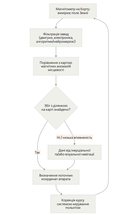
That is why magnetic navigation is rarely presented as a standalone replacement for GPS. The diagram shows that it immediately incorporates a ‘backup loop’ through inertial and visual navigation in case the map match is weak — for example, over a featureless plain or at high altitude.
Northrop Grumman and SandboxAQ: What the American Developers Showed
According to official data, SandboxAQ’s AQNav system continued to operate during the test even under deliberate jamming, maintaining the vehicle’s navigation in the absence of a satellite signal — including over open water.
The trials confirmed that Lumberjack is capable of performing multiple takeoff, flight, and landing cycles in succession. This means the platform could potentially be used not only for one-way strikes but also for reconnaissance and training.
It is known that engineers installed the AQNav software on existing onboard electronics in under an hour, without any additional specialized hardware. SandboxAQ’s Navigation Division General Manager Luca Ferrara noted that the ease of integration gave the attritable platform the ability to gain magnetic-field navigation without any redesign of the hardware.
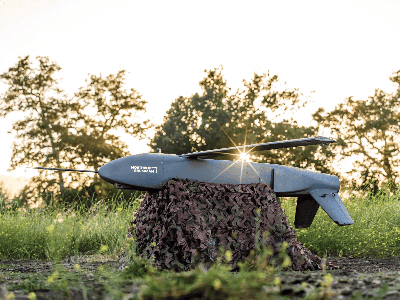
According to Lumberjack program manager at Northrop Grumman Max Schuster, the project went from concept to working flight in a short timeframe thanks to the combination of off-the-shelf technologies from different companies.
According to TechTimes, the global geomagnetic anomaly model EMAG2v3 — the primary public reference dataset — has uneven resolution: a grid of 1 to 20 kilometers depending on the region. This means that over geologically ‘rich’ areas navigation accuracy will be higher, while over plains or ocean areas it will be lower.
Neither SandboxAQ nor Northrop Grumman disclosed the specific geography of the test or the positioning accuracy achieved. All that is known is that the system meets the military standard for permissible error (Required Navigation Performance). By this metric, it outperformed traditional inertial systems, which gradually accumulate error without external correction.
The technology is participating in the Pentagon’s Transition of Quantum Sensing program of the U.S. Department of Defense, which evaluates magnetic navigation systems for military autonomous vehicles. AQNav’s total flight time at the time of the Lumberjack test exceeded 450 hours across four types of aircraft, including flights alongside the U.S. Air Force on C-17 Globemaster III and C-130J Super Hercules transport aircraft.
SandboxAQ’s press release states: the wars in Ukraine and the Gulf countries have proven that cheap expendable drones now regularly operate in environments where GPS is either jammed or spoofed with false coordinates. This is the official rationale the American company presents to investors and customers.
The Ukrainian Front: The Same Problems, Little Time for Development
While American companies are staging demonstration flights at testing ranges, in Ukraine alternative navigation has already been developing along several tracks simultaneously for several years.
Ground-Based Radio Beacons Instead of Satellites
Deputy Commander-in-Chief of the Armed Forces of Ukraine Vladyslav Lebedenko reported that special navigation stations — ground-based beacons — have already been deployed in pilot mode in Sumy and Kharkiv oblasts. Interceptor drones, light aircraft, and other sensors use their signals to navigate in the very zones where friendly EW suppresses the satellite signal and prevents the enemy from using it. According to him, the rollout of this network is planned to expand.
A similar but commercial solution was developed by Ukrainian company Vyriy: a board with an antenna is installed on the drone, while radio transmitter beacons are pre-positioned along routes — on the ground or on various structures — and the vehicle uses their signals to hold course even when both satellite navigation and radio communication with the operator are jammed. The developers position this solution as a cheaper alternative to fiber-optic cable drones.
Magnetic Navigation: A Ukrainian Development
Geophysicist Mykola Orlyuk and other Ukrainian scientists are working on a technology very similar in principle to AQNav. However, they are developing it on the basis of digital geomagnetic field maps specifically of Ukrainian territory.
The drone is equipped with ultra-sensitive magnetometers that, during flight, compare measured field parameters against a reference digital map in real time. Orlyuk likens this principle to the operation of modern visual navigation systems. The main challenge is the drone’s own magnetic interference from its motors and electronics, which must be filtered out in order to obtain a clean geomagnetic signal.
Visual Navigation Based on Neural Networks
Simultaneously, a track is developing in which the drone navigates visually — matching camera imagery against a pre-loaded terrain map using neural-network-based algorithms.
Super-Technology or a Forced Solution?
Magnetic navigation cannot be a universal replacement for GPS and has its own physical limitations. At high altitudes the magnetic field becomes more ‘smoothed out,’ so positional accuracy decreases. The technology therefore works best at relatively low altitudes and over geologically heterogeneous terrain. Moreover, magnetic anomaly maps need to be continuously updated, and the vehicle’s motors and electronics generate magnetic interference that overlaps with Earth’s natural background — which, as already noted, must be compensated for using neural-network-based filtering algorithms.
That is why, in both the American and Ukrainian cases, the discussion is not about a technology that will single-handedly ‘replace GPS.’ Rather, it is the principle of layering different data sources on top of one another: satellite (when available), inertial system, visual navigation, magnetic navigation, or ground beacons — depending on which channel can be trusted at any given moment.
When one of them fails or is deceived, the others compensate. That is precisely why Lumberjack combined magnetic navigation with visual navigation rather than relying on a single system alone. That is precisely why Ukraine is simultaneously developing beacon, magnetic, and neural-network visual navigation.
What to Expect in the Future?
Previously, such systems were installed only on expensive transport aircraft worth tens of millions of dollars, where a few extra kilograms and a few tens of thousands of dollars in costs are not critical. For an expendable strike drone, every extra gram and dollar of unit cost matters. The fact that AQNav was reduced to a lightweight software solution running on existing electronics without a specialized computer theoretically opens the path to even cheaper and more mass-produced munitions.
In Ukraine there is far less money and time. At the front, a drone is a consumable, so several thousand vehicles are needed per month. Ukrainian developers are therefore focused not on ‘technology of the future’ (as their American counterparts are), but on creating a working, inexpensive solution that can be rapidly put into series production.
The following materials were used in writing this article:
- Army Technology — Northrop Grumman and SandboxAQ demonstrate quantum sensing magnetic navigation
- The Quantum Insider — SandboxAQ Tests GPS-Free Navigation on Northrop Grumman Drone
- Quantum Computing Report — SandboxAQ and Northrop Grumman Flight-Test AQNav Quantum Navigation on Attritable Drone
- Interesting Engineering — Northrop achieves first-ever successful quantum navigation test on one-way attack drone
- Inside Unmanned Systems — Northrop Grumman’s Lumberjack drone flies using unjammable quantum-powered magnetic navigation
- Australian Defence Magazine — Northrop Grumman Lumberjack tests quantum navigation
- MigFlug — Northrop Lumberjack Drone Flies GPS-Free on Quantum Navigation
- RuntimeWire — SandboxAQ tests GPS-free navigation software on Northrop Grumman’s expendable drone
- dev.ua — Vyriy створила маякову навігацію для дронів, яка працює без GPS і зв’язку
- dev.ua — Росіяни навчили “Шахед” орієнтуватися по наземних радіомаяках замість GPS
- dev.ua — Розробник дронів Vyriy навчив летіти без зв’язку свої ударні FPV: режим “круїз-контроль” підвищує ефективність на 20%
- dev.ua — В Україні розпочали масове виробництво дронів Sky Devil, які можуть працювати без GPS
- dev.ua — Неможливо збити з курсу: українська Blue Arrow створила навігацію для дронів без GPS
- 24 Канал — Український дрон Lucky Strike-2.1 повертається без GPS
- LIGA.net — Украинские дроны смогут работать без GPS – производитель
- “Геофізичний журнал” (journals.uran.ua) — випробування магнітометричного комплексу LEMI-026 на мультикоптері DJI Інститутом геофізики НАН України